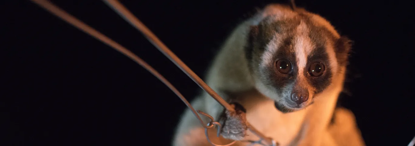

Leslie Annette Paige, a graduate student in biological anthropology, met her first slow loris during an internship at the Duke Lemur Center in the summer of 2017. “It is hard to not be captivated by these animals,” she said.
Small, shy, and nocturnal, slow lorises are often described as resembling children’s teddy bears. They are also the only venomous primates in the world. Modified sweat glands allow them to secrete a toxin strong enough to take down a human-sized predator.
Paige is now studying a critically endangered species of loris, the Javan slow loris. She collaborates on this work with the Little Fireface Project, an international nongovernmental organization founded by Anna Nekaris, PhD '00, and a professor at Anglia Ruskin University.
Paige recently presented her slow loris research at the Geo-Resolution conference hosted by the National Geospatial-Intelligence Agency and Saint Louis University.
“We are using remote sensing technologies — namely satellite and drone imagery — to map loris habitats in the highest possible resolution,” said Paige, who works in the laboratory of Emily Wroblewski, assistant professor of biological anthropology. “Then we can conduct geospatial analyses to look at how loris space use relates to features we can distinguish in the landscape.”

Paige came to WashU with a strong interest in geospatial technology but no practical experience with the tools. She took GIS courses in anthropology and environmental studies, ultimately developing a collaboration with Alex Bradley and Bill Winston in the Fossett Laboratory for Virtual Planetary Exploration after taking their course "Geospatial Field Methods." "They provided training in drone survey methods and data analysis techniques as well as the equipment that we have used to conduct our surveys," she said.
The kind of geospatial analysis Paige is doing can help conservationists designate priority areas for canopy bridges for slow loris. These bridges give the tree-dwelling lorises a way to traverse agricultural fields and other obstacles. “They can access resources without having to go to the ground, where they are vulnerable to dangers from predators,” Paige said.
On a larger scale, Paige sees many ways geospatial tools can be used to design more effective land management, restoration, and species protection plans.
“I am hopeful that others will see how drone-based imagery expands our understanding of landscapes and associated animal habitat use,” she said.
Header image courtesy of Little Fireface Project